Showing posts with label Lake Superior Trip. Show all posts

Tuesday, 31 May 2011

Motorcycling around the province

Greg Friese, US-based EMS trainer, geek deluxe, mentioned a bike ride he took.

Greg Friese,
Elearning designer, writer, podcaster, blogger, presenter and paramedic.
Podcast: Interview with Living and Dying with Dignity author Jennifer Jilks

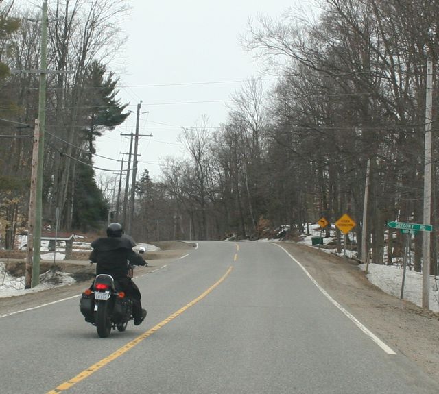
This prompted a photopost of motorcycles. I have several photos in my collection. I like my drive-by shootings!
Most drive better than those in cars, who figure that driving rules are suspended in cottage country!

We get a lot of people riding bikes, more women than I noticed.

There is freedom in the ride.
Camaraderie, too.


I love how they line them all up! LCBO, Bala

This is the road where 3 drove drunk, into the water to their deaths.

All seasons!


 When we took a trip north to Lake Superior Park I noticed a lot of happy people tripping.
Note her licence plate! 'Delish'
The sheer distances mean bicycling is out of the question!

SE Ontario

Gravenhurst OPP

Bala trippers

Tuesday, 12 January 2010

Ghosts from the Day - Part 2

In 1876, the Muskoka Milling and Lumber CO. built a village, with housing and a school for the millhand's children. There was a church, and the Rossin House Hotel for visitors (Brown, p. 91). All would have been well, except that while lumber barons were floating their logs down river, or across the bay, sawdust poisoned fish spawning grounds. They were taken to court, the case dismissed, and eventually, despite this early warning, portent of things to come, the mill shut down in 1895 due to over-cutting.


Environmental Issues

Land rights

Settlements, created by early settlers, who travelled from Paris and London, to the deep wilderness, learned to farm. Read Lost in the Backwoods  or  Book Review: Raisin Wine for more information. This is a common story for South, Central and Northern Ontario.  However, imagine the impact on the tribes who had hunted and gathered for many years in this area. (Photo from Pancake Bay Trading post!)

Overfishing

A royal commission in 1898 found that Georgian Bay fishermen were using undersized nets, and exceeding the number of permitted nets. They estimated that more than 2,000 nest were strung in the Bay. This combined with effluent pollution, created these ghost towns.


Excess hunting and fishing contributed to the ravaging of the land. Native Peoples knew not to take more than their share, but greedy companies (HBC & NWC) sent in map makers, and created outposts which exploited the land. Settlers, fishermen and lumber companies cleared the land, decimating the ecosystem.


Logging Operations
Communally owned land was being begged, bartered, treatied and stolen away. In the meantime, the logging business in this part of the Great Lakes ramped up big time. Unfortunately, it was the mills that did damage to precious fish stock. Fishing harbours were profoundly affected by the mills.This photo is from 2009, of Mamainse Harbour in the fog. A former busy fishing port.

There was much action from Tobermory, the Bruce Peninsula, across Georgian Bay and the North Channel. Our visit to Lake Superior Park showed us some of these quiet, empty ports. Saw mills cut logs for schooners to haul out to settlers in ports. In the winter, as with Muskoka, many worked cutting and hauling logs. This was the time when the bogs were frozen and logs were piled on riverbanks awaiting spring thaw. Log jams, and accidents took their toll on families.

These massive logging operations in Canadian territory did a booming business, if you'll excuse the pun, with the USA. There were issues with this sort of cross border shipping, and one lumberman moved his operation (in the dead of night) from the US to Canada since even in the 1800s big business was seeking to protect its own. Many began to take advantage of the great pines. Eventually, Canadians built mills.


At the peak of the White Pine harvest they were taking 400,000 trees a year. Trees that were 20' around the base. See History of Nepean for more information. Sir John A. McDonald wrote to the Premier of Ontario:
The sight of the immense masses of timber passing my window every morning constantly suggests to my mind the absolute necessity there is for looking into the future of this great trade. We are recklessly destroying the timber of Canada and there is scarcely
a possibility of replacing it.”


But the mills...and a spot called Muskoka Mills, takes its place in history and is an example of how lives were changed by development and settlement.

Milling in Georgian Bay peaked by the decade of 1910, rivalling that of Ottawa, but limited by the government dictate of 1898 legislation requiring that all timber cut on Crown Land by milled in Canada. Shaped by the West Wind quotes James Angus,  writing about A.G.P. Dodge, the owner of the Georgian Bay Lumber Company:
By then, once the mills were no longer viable, lands were sold to cottagers, who longed for the wildness and wilderness of Northern Ontario. Some mills have become heritage buildings, but many, according to *Vanished Villages, have simply gone to decay.

This is the harbour in Blind River, formerly a busy port, with fishing and logging, but now for seasonal visitors and leisure boat activities.


Resources

Ghosts from the Day -Part 1

Ontario Visual Heritage Project

*The book is called, Vanished Villages: Discover whistlestops, old mills, lost hamlets, relics and ruins of Ontario, by Ron Brown (1996)
~Some photos from Canada.ca archives, see History of Nepean.
~See also: Lament for a First Nation: the Williams treaties of Southern Ontario
 By Peggy J. Blair (Amazon.ca, $80)
~Artist Gallery: A.Y. Jackson Autumn, Muskosh River
~Shaped by the West Wind: Nature And History in Georgian Bay, by Claire Elizabeth Campbell - 2005 - History - 294 pages
The ghost of log-driver Sandy Gray haunts the falls on the Muskosh River, ...
Tugs towed log booms from rivers mouths on the Bay to American mills 

Friday, 3 July 2009

Skywatch Friday

massive skies in rainbow colours
angels light their lamps --
solitary lifeboat
~~~~~~~~~~~~~~~

The skies are massive; the clouds phenomenal in Lake Superior's bays. The music is by Ian Tamblyn: Days of Sun & Wind. It is bittersweet knowing the Edmund Fitzgerald sank an hour off shore. I spoke to the daughter of a captain of the day. Her father knew the cap't of this ship. It was a terrible tragedy.

1958
On June 7, 1958, the 729-foot Great Lakes ore carrier Edmund Fitzgerald was side-launched into the harbor —signifying the birth of the ship.
www.chroniclet.com
1975
On November 10, 1975, in the most famous shipwreck in Great Lakes history, the Edmund Fitzgerald sank in a treacherous storm on Lake Superior.


Visit more Skywatchers by clicking on the badge for the meme.


Tuesday, 30 June 2009

Lake Superior


After our trip north to Lake Superior, I was drawn to do some research. One thousand million years old, it is. Created when 2000 degree basaltic lava rose up from the earth, basaltic, rhyolite and gabbroic flows and a crust that sagged into a huge depression.

The sheer immensity of this lake, and its big skies, inspires me. I am still processing all the photos and video. And we only visited the eastern portion. Along the drive the mountains rise up, one million years of sediments eroded from mountains in the east. As Dr. Joseph McInnis says, in Fitzerald's Storm: The wreck of the Edmund Fitzgerald, "four gigantic glaciers shuddered out of the arctic", 2 million years ago.

It was the last glacier, Wisconsin, 115,000 years ago that moved like a giant cougar across the land, tearing of the hill tops, with such weight and "granite teeth", that scoured, stripped, ground, and pulverized the rock. The massive sand and gravel pits dot the highways, evidence of the massive movement of earth.

The ice, he says, was hundreds of fathoms deep and it gouged sandstone, siltstone and shale. The book is an excellent read, and includes some geological information. The lake bounds Minnesota, Wisconsin, Michigan and Ontario. The lake is 400 miles from east to west, 160 from north to south. It contains 1/10 of the world's fresh water.

In the 1800s the whites moved in to clear cut the land, ripping the pine and spruce to transform them into ships and houses. Them, in the 1840s, copper miners from England and Germany began exploitations of the lake effect snowland. A major transportation route, the lake holds 350 ships that have sunk in its cruel, unpredictable weather. With a maximum depth of 1300 feet, it roils with the lake effect winds picking up moisture much as the glaciers did many moons ago. During the sinking of the Edmund Fitzgerald (Nov. 10, 1975), it raised 16' high waves, with winds of 58 knots. A person would last 30 minutes in November waters. Accidents on the ship were common in shifting seas, with metal bulkheads and dangerous, slippery conditions.

In the meantime, the First Nations, Ojibwe in the east, perceived the lake to be a living, breathing body, always moving, changing, with many facets. The Fog had a big impact on life. Their lives revolved around nature, with artifacts from 8800 BCE having been found around the lake. The forest's harvest of maple syrup, spring fish runs, berries, herbs and, of course, migrating geese made it prime for living off of the land.


Gargantua Bay

We bought a great CD, all Ian Tamblyn songs, Coastline of Our Dreams, and it was amazing to be videotaping in Gargantua Bay, Lake Superior Park, listening to songs about these places.

Songs of the northern shore; the music on the video below is 'Heart of the Run', and 'Black Spruce'. It was bizarre playing the CD and hearing them sing of the 'mighty Gargantua', and the other places we were driving through. I have not been this far north in years.

The climb up to see the pictographs was so tough. You can see the rock fissure on the right, with the waist high metal railing. They do lose tourists in Agawa Bay as the winds whip up the water and unexpected swells wash them away. We both did well, with bad backs and aches and pains, to climb up the rock and around the roots. It wasn't until the next day, when walking along the next trek, while walking beside the Pinguisibi R., fairly flat terrain, as you can see, that I tripped on a root. Two hand-sized bruises on my shins, a sliver in my hand where I broke my fall with a root, and a twisted ankle. When we returned to our resort Sylvia, one of the daughters, prescribed ice and lots of wine. The TLC at the resort, as well as the Rx, eased the pain!

Evidence of peoples from across 4000 years are quite absent in these spots. There is a reverence in the glorious rocks, trees, sparkling waters and the flora and fauna in the lack of human interference in the land. The park is pristine. There are a few spots, e.g., out buildings where campers must sign in, lots of road markers, but little else.

On the trail we saw two sets of camps, a truck and a car. That was it. We were 14 km driving, and 2 km walking, off the beaten path, and very isolated. Seeing the tracks of the critters was shocking - if only their size. We are so low on the food chain!
Our accountant is driving up to Lake Superior Park to camp today. What a coincidence. He is a serious kayaker and camper. We don't so camping (a long story!) but wish him well. We are awed by those who can and do. The mosquitoes, on our trip to the Bay, were vicious with no wind. We had to eat the sandwiches we'd packed while standing up and swatting them.
In my mind's eye I can see ancient spirits canoeing, making their way across this fearsome la
nd, creating the pictographs we saw on the rock face at Agawa Bay. Images of the huge creatures that walk this land gave me shivers. We drove along the incredible roads and were amazed.

What a trek. First you drive over a long, winding, bumpy road, then walk 2 km to the beach area. Mike, our park interpreter, explained that it was a pretty demanding drive, with potholes here and there. Was he ever right!

The boulders poke up through the road, as well, after the gravel, sand and silt are washed away in heavy rain. I wanted a t-shirt saying "I drove to Gargantua* Bay!"

*pronounced GAR'-gan-twah


~~~~~~~~~~~~~~~~~~~~~~~~

Monday, 29 June 2009

Fabulous food and views


Lake Superior - what land, what views as we drove along. I tried to keep the videos short, to give just a glimpse as we drove along. An avid amateur photographer, I forgot to recharge my digital camera battery, I took 200 photos on the way there the first morning, then forgot I had the video camera with me.


Here is our resort, as we drove in the driveway. It is great to travel in the shoulder seasons. It was $72/ night. A very affordable trip. We bought a great CD, all Ian Tamblyn songs, Coastline of Our Dreams, with a variety of artists.


Sunday, 28 June 2009

nature nut needs an eagle eye


Driving along, minding our own business....trying to keep an eagle eye out.

Lots of forest, having left the North Channel of Lake Superior.

Just at the side of the road.
Drive-by shooting, just on the edge of a Native Reserve.

How ironic is that?

I did stop the car, though. A drive-by shooting was less than the moment demanded.

The bird was somewhat irritated with me, voicing an opinion about the dumb two-legged ones.

I've seen ravens and crows harass people and didn't spend a long time irritating the creature!

Then, what should fly into the car, but a lovely wee critter.

It is the smaller things in life that are just as interesting!


The research tells me that this is an osprey, but the pun was a fun one!

Scenic Sunday #50 - Take Me Home!


A scenic tour of N. Ontario highways and rock. The little trucks give some perspective. I cannot imagine the work involved. Well, I can, since we drove past the road work around Parry Sound. There are only 3 seasons: bugs, snow, construction - none mutually exclusive!

You know it is summer in Ontario when there is traffics, flaggers, bugs, and tourists. Here is the view on our way home from Lake Superior. The Parry Sound construction is massive. The rocks are impressive. The music is by Betty & the Bobs, performing Ian Tamblyn's Take Me Home.

Scenic SundayClick here for more scenic Sunday views

Friday, 26 June 2009

fog and fury

I continue my June journey along the coast of Lake Superior. This was the view from our resort. I gladly watched the sky.

Travelling in June is incredibly affordable. School is not yet out and we are given much attention from our hosts. Visit more sky watchers by clicking on the badge below.

What great views this land provides...Batchawana bay. A lifeboat from the Edmund Fitzgerald was found in this bay.
The fog rolled in, and the temperature dropped from 20 to 12 degrees C. as we drove up the coast to Pancake Bay. We stopped in Mamainse Harbour. Very eerie as the geese came in.

But the weather is treacherous. The The Fitzgerald was lost an hour out.

We met Diane Sims, an author living in Stratford, whose father was a ship's captain and knew the captain of the E.F. and the impact the sinking had on the community. Much like that of recent airplane and not-so-recent ship losses, with artifacts being found after the fact.
The geese rolled in with the fog. A bit eerie.

I'm glad to be home!