☔AUGUST 2022 🌧Precipitation
- Beaches open or closed in our Health Unit: weekly reports.
- More local ❄️WEATHER DATA☔ over the years.
A mesoscale convective system just traveled over 1600 km across Europe.
It began near Barcelona, moved across the Mediterranean Sea, went over Italy, and traveled all the way to the Czech Republic.
One of the most persistent complexes of storms you will ever see in Europe. pic.twitter.com/XgWn6FwQ8C
August 7th – overnight 10 mm.
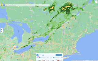
What a relief! We had rain. Finally. There was thunder and lightning nearby, but the storm seemed to skim to the north of us. Even Ottawa had rain.
August 3rd
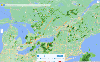
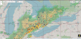
I was really disappointed. It was a huge storm, with lightning strikes everywhere. I have found that the lightning map gives a good indication of the direction of the storm.
We didn't even have enough rain to gather in the rain gauge. It all petered out as it moved across the continent.
Elora had a tornado.
Very busy day in the Guelph-Fergus area. My SW end of the line has been visually interesting, but nothing like what we saw in Fergus. @weathernetwork #onstorm pic.twitter.com/3IVvPnBCPB
— Mark Robinson (@StormhunterTWN) August 3, 2022
Shakespeare looking grim. #onstorm pic.twitter.com/mSealB220j
— Trina Stewart (@Trina_Stewart) August 3, 2022
| AUGUST | rainfall |
| 2013 | 167 |
| 2014 | 185 |
| 2015 | 121 |
| 2016 | 89 |
| 2017 | 116 |
| 2018 | 48 |
| 2019 2020 | 59 179 |
| 2021 2022 | 37 82 |


No comments:
Post a Comment