| NOVEMBER | rain(mm) | snow(cm) |
| 2013 | 68 | 20 |
| 2014 | 15 | 26 |
| 2015 | 54 | |
| 2016 | 39 | 25 |
| 2017 | 84 | 10 |
| 2018 | 94 40 |
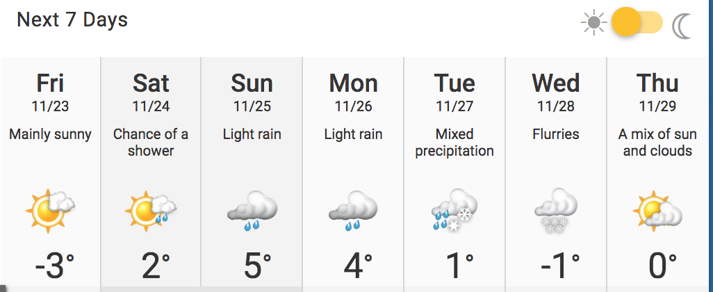
Wed. Nov. 28

Tu., Nov. 27 –
It's rolling counter clockwise Tuesday.


Monday, Nov. 26 – 20mm
We woke to fog, with a major storm on the way. It looks as if we have rain, not snow. I'd truly prefer snow!

Saturday, Nov. 24
Freezing rain warning. This storm is rolling up the continent. Happily, it was just rain!


Thursday, Nov.22

Sun., Nov.18

Nov. 15
It's another cold day, today, with a storm on the way.

Nov. 14
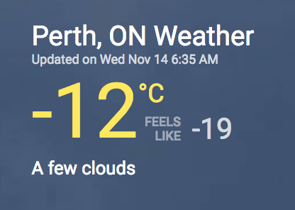
— Sgt Kerry Schmidt (@OPP_HSD) November 14, 2018
Nov. 13 – interesting patterns!

Nov. 9 – Snow is on its way!
A strange radar blip! I collected it and melted it: 9.65mm.

Nov. 6
There is a huge storm system, rolling up the continent. The Maritimes, out est, still have power outages from the last storm. They are warning that this storm will bring winds.

 |
| Can you see Perth??!! RAIN!!!! |
Nov. 1 – 14.8 mm

Historical Data
Massive rains in 2017. Snow this month. There was only 4.5cm snow in 2016. November brings a mix of rain, snow, sleet and hail. I continue to melt the snow, to determine the amount of water in a snowfall.
No comments:
Post a Comment