I collect data, and stories about precipitation, here in a page (see above), all month. Also, other weather stories, out of interest. We are susceptible to Mother Nature, and knowing if we our in a drought, or not, helps me with my gardening and my well water usage.
Our Historical Data: August Precipitation

| 2017 | 116.3 mm |
| 2016 | 88.80 mm |
| 2015 | 120.7 mm |
| 2014 | 185.25 mm |
| 2013 | 166.5 mm |
Earth, Air, Water, Wind and Fire
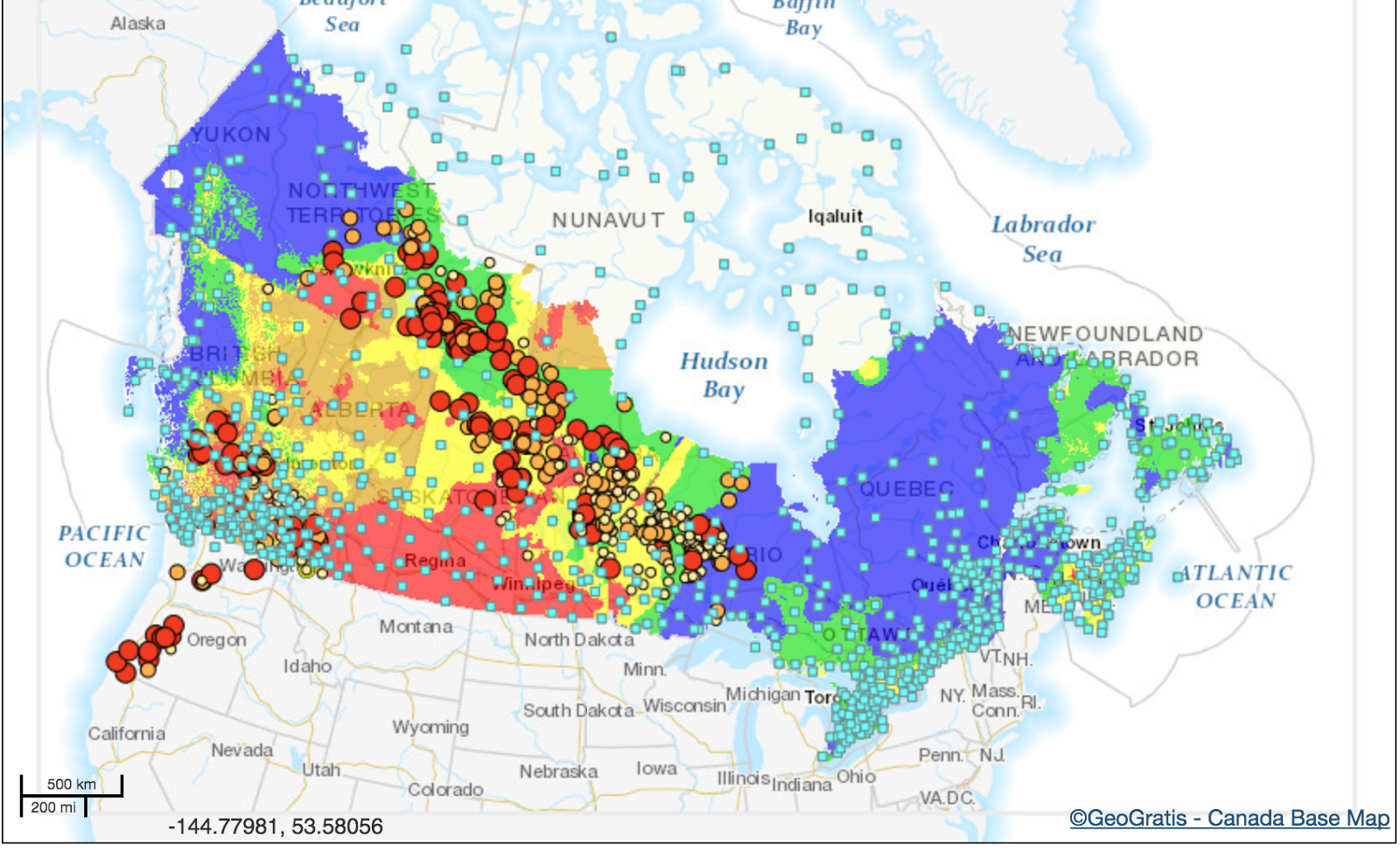
FIREThis last day of August, Wasagamack, Manitoba First Nations are in evacuation. MLA Judy Klassen encourages people to donate to Red Cross on their behalf. I did so.
I went to:
Manitoba - Canadian Red Cross
as they have a real need.
Higher-than-average fire activity<=Manitoba
 |
| Wasagamack, Manitoba First Nations |
Some families were split up and children were panicking when a forest fire forced members of a northern Manitoba First Nation to flee their homes in the dark Tuesday night.
Search Results
WATER and WIND
They are still in a flood situation in Texas. The photos are scary. Canada is sending help, as has Mexico, ironically enough.
Aug. 29 Flooding in Windsor
Windsor is a mess, after two days of rain. It's located at the west end of Lake Erie, across from Detroit, so I'm sure they are suffering, too.
“Radar and observations indicate 80 to 150 millimetres have fallen between LaSalle and Tecumseh over the last four hours,” the weather office said at 3:30 p.m. Tuesday.

“Radar and observations indicate 80 to 150 millimetres have fallen between LaSalle and Tecumseh over the last four hours,” the weather office said at 3:30 p.m. Tuesday.

.@WindsorPolice & @WindsorFire1 are warning people not to drive if you don't have to. This is why @CTVWindsor @AM800News pic.twitter.com/2JKSUKiUcT— Christie Bezaire (@CBezaireCTV) August 29, 2017
– Hurricane Harvey is still dropping rain
This is just incredible to watch as it unfolds in real time:— Mark Sudduth (@hurricanetrack) August 29, 2017
The camera is in Houston along Barker Cypress Road.... https://t.co/hx6QLtuvBy
Hotter oceans mean wetter storms. Explainer by @YEARSofLIVING #Harvey #HurricaneHarvey #climatechange pic.twitter.com/WvjefJLcd8— UN Climate Action (@UNFCCC) August 29, 2017
Aug. 28 – what a disaster
60 Hours of #Harvey: This NOAA #GOES16 loop shows #HurricaneHarvey from 8:00 pm (EDT) on Aug. 24, 2017 through Noon today, August 28. pic.twitter.com/GXwUScu8ti— NOAA Satellites PA (@NOAASatellitePA) August 28, 2017
Aug. 25 – Hurricane Harvey
Inner-eye wobbling & stretching in Hurricane #Harvey. These eyewall processes on minute/hour time scales will help determine landfall winds pic.twitter.com/vHdytqnZNg— Ryan Maue (@RyanMaue) August 25, 2017

Here, it is just cold!

Aug. 23 – nearly 6mm.
Aug. 22 – hail in Kanata (Ottawa 30mm), pouring rain in Muskoka (92mm), microburst in Montreal
Thousands without power Wednesday morning after storm hits #Montreal https://t.co/5gNUUpQFeb #Quebec #MontrealStorm— YYC Preparedness (@YYCPreparedness) August 23, 2017
— Nathalie Laflamme (@NatLaflamme) August 22, 2017
— Nick d'Entremont (@ThruNicksLens) August 22, 2017
Millar Hill Rd has a couple slight wash outs.— Muskoka411 News (@Muskoka411) August 22, 2017
Photo Credit William Kilpatrick pic.twitter.com/Vt8Cb382Ql


Aug. 18 – big storm: 19 mm
The satellite image is very cool! Then the storm rolled in.


Aug. 16 – hurricane Gert!
Here is latest path for Hurricane #Gert. Expected to get to Cat 2 despite cooler SST's and will stay out to sea pic.twitter.com/QrRcXnJmLa— Jaclyn Whittal (@jwhittalTWN) August 16, 2017

Aug. 15 – 2:00 a.m. it rolled on through: 6.6 mm, 6 more at 2:00 p.m. in the afternoon.
 |
| 2:00 p.m. |


 |
| 2:00 a.m. |
Aug. 12 – 50 mm!


Who saw that coming early this morning? We had 12.4 mm.

Aug. 11 - to
Environment Canada says tornado with 180 km/hr wind speeds hit Hawkesville, Ont., farm: https://t.co/FL3IgvsVht pic.twitter.com/n1xbautHiM— CBC Toronto (@CBCToronto) August 12, 2017
Reports of a tornado in Hawkesville, near Kitchener-Waterloo.

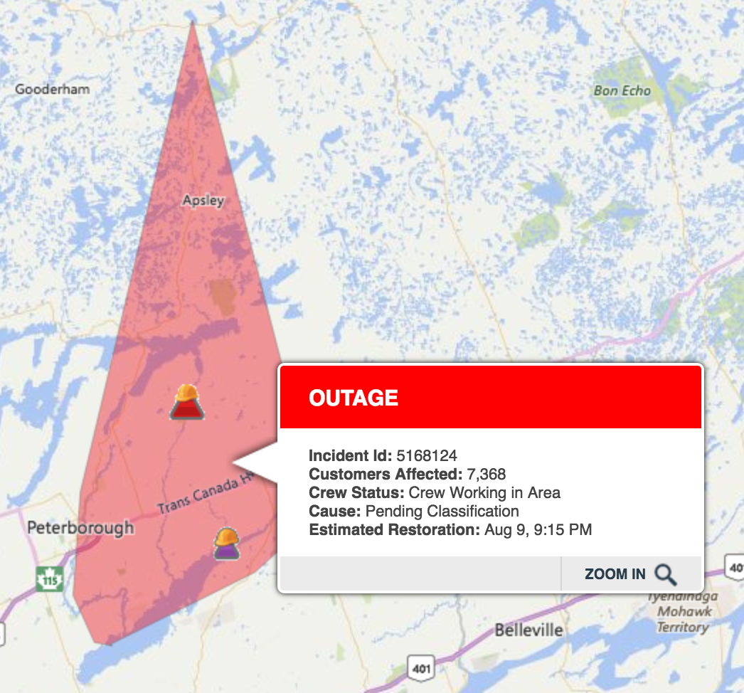
Aug. 10 – power outages -

Aug. 9
It wasn't a big storm, but it was loud. We had power out about 10 minutes. At 9:20 p.m. it said power out for 32,000!



#Onstorm from Jennifer Jilks on Vimeo.
Aug. 5 - Big storms, bad in Muskoka, and southern Ontario.
Environment Canada Confirms Tornado In Huntsville On Friday https://t.co/yzC6HD9MMf #Huntsville #onstorm pic.twitter.com/g8Kz4ojw3h— Muskoka411 News (@Muskoka411) August 6, 2017
Officially, a tornado hit Huntsville, Lake of Bays, on Friday.


Aerial photo of storm path near Bella Lake courtesy Ray Jarvis #onstorm #Muskoka pic.twitter.com/SYkQGwefft— Cindy Burgess (@cindyburgess) August 5, 2017
Video: Isolated #onstorm damage off Rebecca Lake in Muskoka (Lake of Bays Township). @environmentca will determine if a tornado hit. pic.twitter.com/6mAGRQQOTh— Jeremy Cohn (@JeremyGlobalTV) August 5, 2017
Crews continue to respond to 109 outages affecting 5,169 customers. Visit our map for up-dated ETRs https://t.co/imqhWi8bum— Hydro One (@HydroOne) August 5, 2017
Downed trees, blocked roads, damaged cottages reported as storm hits Muskoka https://t.co/txJnzxF9QL pic.twitter.com/wFLKedYmqM— CBC Toronto (@CBCToronto) August 5, 2017
Emergency crews responding to a plane crash in Lake of Bays (Muskoka) and numerous calls for trees and wires down. #onstorm @AnthonyFarnell— Jeremy Cohn (@JeremyGlobalTV) August 4, 2017
Lanark County:
 |
| Muskoka, Central Ontario, hard hit |


At least, with all the moisture, we have LOW fire risk.
 |
| Fire Ratings in Ontario |
Aug. 3 – 6.3mm

Aug. 2 - long string of storms, power outages! We had 3mm.


Aug. 1st - Maybe rain here, from in the Golden Horseshoe!